
Six miles south-west of Bodmin
PL26 8NF
Tel: (0300) 1234 202
Email: countrysideservice@cormacltd.co.uk
Web: www.cornwall.gov.uk/environment/countryside/cycle-routes-and-trails/goss-moor-multi-use-trail/
Explore the rich natural heritage of this National Nature Reserve
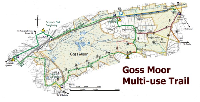
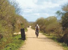
This seven mile circular trail winds its way around the little known expanse of Goss Moor in Mid-Cornwall. It is mostly flat and relatively easy - much of it off road - allowing disabled and novice walkers and cyclists easy and safe access to the moors. The trail is surfaced to be suitable for walking, cycling, horse riding and for wheelchair or mobility scooter users and buggies. There are also additional and linking routes on neighbouring Tregoss Moor.
Goss Moor is a 1186 acre National Nature Reserve (NNR), the largest surviving remnant of the Mid-Cornwall moors which was officially opened on Sunday 11th May 2007.
The name is believed to derive from the Celtic word "cors" meaning a boggy or marshy place. The moor has a rich and interesting history. It is a legendary hunting ground of King Arthur, and was later recorded in the 1086 Domesday Book as part of the manor of Tremodret. Tin was extracted here between the 11th and 19th centuries, and sand and gravel quarried between the 1930's and 1950's.
Today's fascinating mosaic of wetland, heathland and scrub is the result of tin streaming and livestock grazing carried throughout the centuries, forming a wild windswept landscape which provides a habitat for an outstanding range of rare plants and animals.
From a distance, the view is deceptive, for the heathland hides a maze of waterways, marshes and still, mysterious pools.
Goss Moor is a unique wild and undeveloped environment to explore and enjoy. Facilities such as shops, places to eat or stay and public toilets can be found in the neighbouring villages - see the map below. There are also attractions, sites of historical interest and places to eat in the surrounding area - so enjoy your cycle or walk on Goss Moor and then visit one of these to make a full day out in mid-Cornwall.
The old route of the A30 road at Goss Moor was notorious for traffic jams and its restricted height railway bridge. A new dual-carriageway A30 was built to the north of the moor in 2007, avoiding the low bridge and Site of Special Scientific Interest.
Since the early 20th century, high voltage power lines and cables have crossed the Moor. The present large pylons were erected in the 1960's, and tracks built for access. National Grid has improved some of these as part of the multi-use trail project. In 1975, a large sub-station was built to the west of the Moor, with a generating facility added in 1995. This sub-station controls the electricity supply for most of Cornwall.
In places, the Trail follows the tracks of old mineral railway and tram lines, and passes beneath one dismantled branch line through an arch which was built to give commoners access to the moors for grazing.
The line crossing Goss Moor is the "Atlantic Coast" branch line between Par, on the Cornish mainline, and Newquay. The Trail crosses the line at Tregoss level crossing and again by bridge at St. Dennis Junction.
Just south of the new A30 dual carriageway a mile west of Roche.

Opening TimesAll Year Admission Free |
Walks and Walking in Cornwall Cycling in Cornwall Cornwall's Railways
Newquay Roche St. Austell St. Dennis Screech Owl Sanctuary