Maps of Cornwall
Mappa A Kernow
Web: www.freemapsofcornwall.co.uk
Know where you are at
Clickable Image Map

District Council Areas
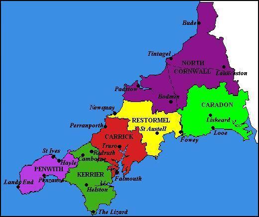
Click on an area above for a detailed map of that district
1:50,000 Landranger Ordnance Survey Maps of Cornwall
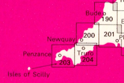
190: Bude & Clovelly
200: Newquay & Bodmin
201: Plymouth & Launceston
203: Land's End & The Isles of Scilly
204: Truro & Falmouth
1:25,000 Explorer Ordnance Survey Maps of Cornwall
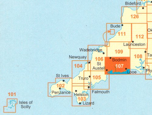
101: Isles of Scilly
102: Land's End
103: The Lizard
104: Redruth & St. Agnes
105: Falmouth & Mevagissey
106: Newquay & Padstow
107: St. Austell & Liskeard
108: Lower Tamar Valley & Plymouth
109: Bodmin Moor
111: Bude, Boscastle & Tintagel
112: Launceston & Holsworthy
126: Clovelly & Hartland
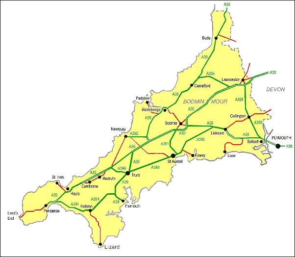
Major roads in Cornwall
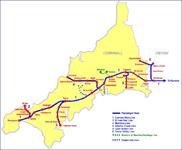
Railways in Cornwall
The Hundreds of Cornwall
Cornwall was divided up into 10 hundreds during Saxon times and this arrangement lasted until the 19th century. All of the Hundreds of Cornwall belonged, and still belong, to the Duchy of Cornwall apart from Penwith which belonged to the Arundells of Lanherne. The Arundells sold it to the Hawkins family in 1813 and the Hawkins's went on to sell it to the Paynters in 1832.
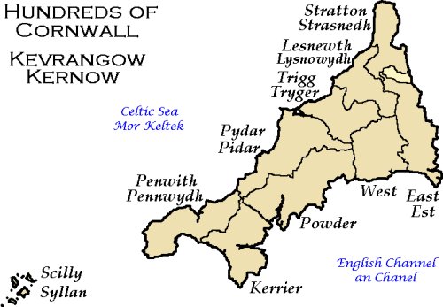
The Hundreds of Cornwall as defined by 1847
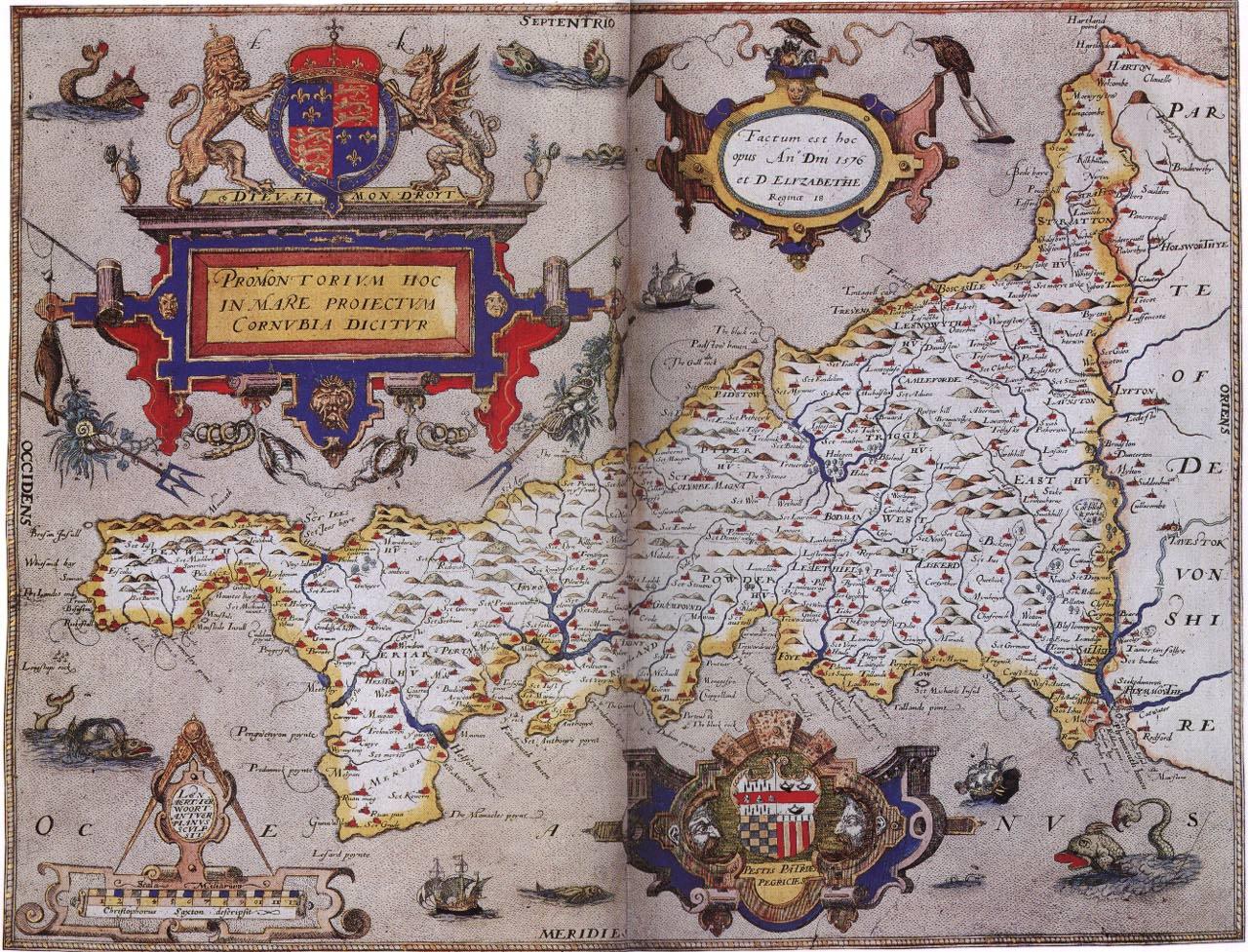
The oldest printed map of Cornwall (1576)
click on map for larger version
How to get to Cornwall
Google Map of Cornwall Cornwall's Bridges Cornwall's Railways Cornwall's Rivers Cornwall's Roads
The Coastal Footpath Cornwall's Tourist Information Centres List of Parishes in Cornwall

